
Barva Volcano in Costa Rica
Overview of Barva Volcano
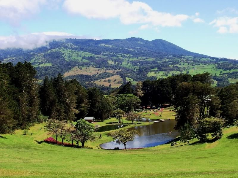
Barva Volcano is a Central Mountain Range volcano located 22 km to the north of San José in the province of Heredia. The Barva volcano is the third highest volcano in Costa Rica with a height of 2,906 meters above sea level. This conical volcano has a crater with a lagoon at the bottom named Laguna Del Barva (Barva Lagoon). This lagoon is 8 meters deep, 70 meters in diameter and it maintains a temperature between 10 to 18 oC. Close to the Barva Lagoon, there are two more lagoons to visit: The Danta Lagoon and the Copey Lagoon. The Barva Volcano covers an area of 1,120 to 1,500 km2 making it the largest volcano in Central America due to its size.
This volcano is located on the western limits of the Braulio Carrillo National Park. As an inactive volcano, it has a large variety of vegetation that is typical of the rain forest. The Barva Volcano houses important aquifers and it is the origin of many rivers and streams that supply drinking water to the Metropolitan area of Costa Rica. The outskirts of the volcano have been inhabited since prehistoric times by the aboriginal tribes of Huetares and Botos. At the present time, this area boasts a lot of agricultural economic activity. The park is visited throughout the year making this an important tourist destination. Located on the outskirts of the volcano are the towns of Barva and Heredia.
History of the Barva Volcano
There are several theories about the origin of the word "Barva" (or its variation Barba) and how it became the name of the volcano and the town where it is located. At the arrival of the Spanish people to Costa Rica in the XVI century, the territory where the volcano is located was part of the indigenous Occidental Huetar Empire, ruled by King Garabito. One of the main officers under King Garabito was Barvac, who ruled over an indigenous town located on the outskirts of the volcano. It is known that a town was situated in that area around the year 1575 so it is generally accepted that the name of the Barva Volcano had its origin from these roots.
According to the national seismological network of Costa Rica, it is considered to be a Type 1 A volcano (a sleeping volcano). Although it is considered to be "sleeping" they maintain a white alert which means it has to be monitored daily. Recent studies of the volcano point to the period of time over 13,000 years ago when the volcano had more activity that was accompanied by many explosions. The last eruption was over 6,000 years ago.
Flora and Fauna in the Area
The volcano has more than 100 species of plants. The majority of the natural vegetation of this area is that of a tropical rain forest with high plant density and height. The rest of the vegetation consists of herbs, ferns and mosses. The trees of the forest are home to more than 80 species of birds, among them the quetzal and the hummingbird. The forests of the Barva Volcano provide a natural habitat to over 20 species of mammals such as the white face monkey, tapirs, coyotes and jaguars among others.
Visiting Barva Volcano
If you visit the National Park of Braulio Carrillo in the Volcan Barva area there are four trails you can visit:
Cacho de Venado: The 1,890 m trail that can be traveled in 1 hour and 40 minutes round trip. This is a guided trail great for bird watching.
Mirador Vara Blanca: This 900 m trail branches off from the main trail. It can be walked in 50 minutes. It has really beautiful scenic views.
Crater Laguna Volcan: 3 km (2 hour round trip). You can visit and observe the Barva Lagoon.
Laguna Copey: 5 km (3 hour round trip). This is a trail recommended to experts in trails and strong hikers. This trail leads you all the way to the Copey lagoon.
You can visit this beautiful area and walk any of these trails. You can also camp in one the designated areas. The park is usually cold and has strong winds so we recommend that you wear a coat, a toque, gloves and a scarf.